Down in the Weeds
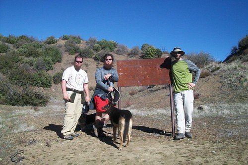
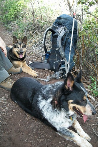
One recent January morning, ZK, Eric from VC Canyoneering, and I convened at the Tar Creek gate with some of the pack for another exploratory.
This trip was to serve several purposes: see the purported damage to the road between Tar Creek and Dough Flat for myself; pick around Bucksnort Spring after having not visited in ages; tick off a section of my EM hike (more about the new “Monumental” Project later); note general conditions of the route from Bucksnort to Ant for the Condor Trail; and — most exciting — locate the old Saddle Skirt trail camp upstream from Ant camp.
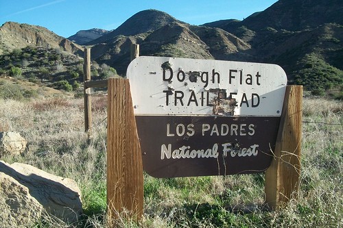
It was a quick 2+ miles up the road — no, it’s not passable to regular passenger cars — to the Dough Flat trailhead, where the ass-clowns with their shotguns have torn things up.
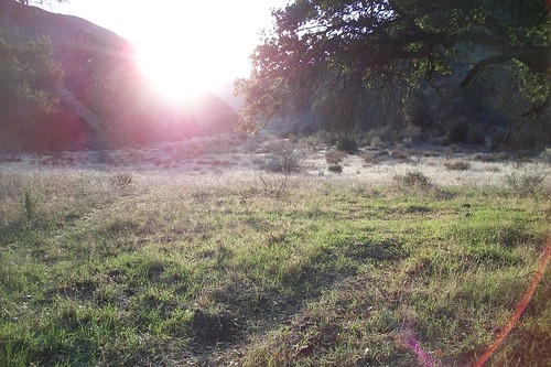
We continued under perfectly cloudless skies and a steady breeze to Squaw Flat and then up the old roadbed to the split where 19W18 heads NE from the main Alder Creek trail. It was all easy going, and we made good time despite our frequent tangent-induced stops to ponder old road cuts, biostratigraphy, oil well caps, and the like. Eric had made this trip a few times in the last couple of years, so (again) he was a good sport to put up with our minutiae-heavy style of exploration.

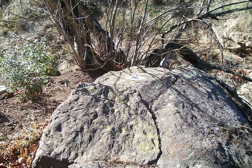
Image courtesy and © Ventura County Canyoneering
Down at Bucksnort, I was glad to see the old Italian cypress still stood like some sort of dendrologically incongruous obelisk. We found a few relatively recent guerrilla camps that had clearly been used in foul weather, and picked around the old building sites; ZK located several foundation pins, bricks and other accoutrements of the old structures that once stood here.
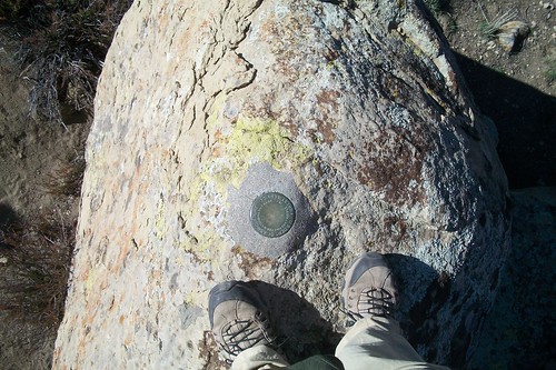
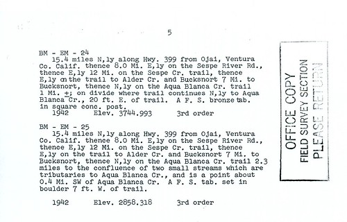
Back along the trail, I picked through the Day Fire-scorched earth and found some shards of an old wooden USFS sign, then cracked open the map folders and withdrew the USDA report detailing benchmarks along this route. I was on the hunt for EM 23 in these here parts. (Why yes, it is these sort of ridiculously inconsequential things that matter most — deal with it.) Surveyor-types called the finding and noting of a monument a “recovery.”

Of course the above-mentioned horse barn is no longer standing, but based on the general description and our 1944 War Department maps showing the old barn’s position, we quickly reasoned said sandstone boulder was one jutting from the field nearby (along a draw down which ZK would later explore and find an old chrome truck bumper and oil well caps).
Success!
We continued easily along the old road, finally reaching the wide meadow which comprises something of a catchment at the very head of one of Stone Corral Creek’s main tributaries. As ZK observed, it’s quite similar in its topography to Mission Pine Basin (sans the crispy Coulters).
Where the old road ends at the divide (and where Gagnon indicates there was once a trail register), we looked around briefly for EM 24, which was to have been off the side of the trail somewhere. After an initial scan, it was decided we would check again on our return from Ant the next day … but it struck me as strange we didn’t spot it, and so I thought perhaps we were searching atop the wrong saddle. Tomorrow, then.
On the singletrack, things narrowed and got brushy quickly, but we made good time on the descent in to Ant. To use trail report parlance I would venture to say the route in sections is “not passable to stock.” Several stretches of failing tread crumbled beneath us — most often along steep hillsides or overlooking ravines — but other stretches have held up well post-Day Fire, and have been flagged by at least two parties in recent years.
Near where the trail finally crosses the unnamed creeks, we recovered EM 25 beneath dormant bigleaf maples and sycamores, and continued toward Ant.
Ant is a great spot, even with the fire damage. Walking in to it I was reminded of an E.O. Wilson quote that at the time I couldn’t quite articulate (but later checked). The site is spacious, with plenty of room for tents out in the meadow if one were to haul a large crew along, and plenty of shade with the huge oaks. Apparently it was these qualities that had prompted a cadre of (presumably) pot-growers to use it as base camp in the past year. There was litter. Everywhere. Mildewed tents, sleeping bags, cookware, two-burner stoves, trash bags, Powerade bottles, fuel canisters, a Coleman lantern (still with box), and all sorts of junk. Disheartening. Many of the bags contained receipts from a San Diego Big 5 and a market along Blvd. Isidro López Zertuche in Saltillo, Coahuila.
That Wilson quote was “When you have seen one ant, one bird, one tree, you have not seen them all,” and in keeping with my tendency to use quotes far out of context I felt this to be true here. Ant camp always seems to be reinventing itself, for this wasn’t the same Ant I’d visited ages ago. Photos from decades past show a pleasant oak-shaded spot that was likely a welcome respite for backpackers and horsepackers coming from any of three directions (Piru, Cobblestone, or Dough Flat). In recent years it’s been something of a dustier, more run-down Cienega doppelganger with a table (increasingly rare in the backcountry) and a complement of hearty cookware. I’ll be interested to see what becomes of this site in the coming decades.
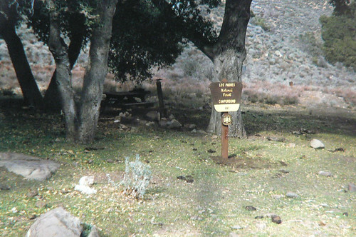
Ant Camp, February 1967
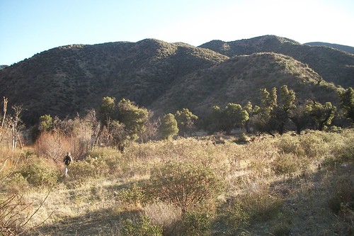
After some general lounging around Ant, we headed upstream to see if we couldn’t locate Saddle Skirt.
Saddle Skirt has been on the USFS, USGS, and Harrison maps for ages, but — like Ellis Apiary — has effectively been abandoned, and I often question why it remains on the maps. Further, none of the current maps show it in its correct location, so I was keen to determine its actual placement. Some of the VCC crew had already made a sojourn up Agua Blanca in search of Saddle Skirt without luck, but I was guardedly optimistic we could sort it. Because if you listen to the trees closely enough, you can hear whispers of backcountry trampers who’ve seen the camp in the recent years …
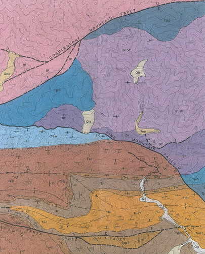
The wicked geology of the Upper Agua Blanca
Holy bear-choking blackberry brambles, Batman! Beyond the initial curve upstream, things got thick in a hurry. Rock cairns and some recent flagging gave me hope that despite conditions we’d still manage to tick off another Diamond in the Rough, but as the canyon lost its light and we approached our agreed-upon turn-around time, we were nowhere near as far upstream as I’d have liked. Eric reminded me of Visteur’s “summit is optional, return is mandatory” line, and I conceded I would have another opportunity to search out the elusive trail camp.
Sticking to our return time allowed enough daylight to get back to camp and set out the bedrolls, collect fuel, and generally enjoy the space the site provided. Must-have-a-project Man (ZK) took some of the rope left by the previous occupants and set about repairing the springs of one of the bed frames, intent on using it for his night’s slumber. I got the fire going, brushed out one of the resident cast-iron skillets, and set the fajitas to the flames. It was a very relaxing evening of lamb chops (with mint sauce of course), steak fajitas, Murphy’s stout, and Aberfeldy single malt. The pack gnawed their steaks contently and as we let the fire wane after burning some of the cardboard and cotton trash, the stars lit the sky in wide gauzy swathes.
As we stretched out beneath the stars for a night’s slumber, a pair of owls began a long-distance conversation down along the Agua Blanca, and continued their correspondence through most of the night.
The next morning, we gathered the more toxic items (insecticide, fuel canisters, bug spray, lighter fluid, etc.) from around camp and packed them up. It was a slow morning-style climb back out of the Agua Blanca drainage, and just as we approached the divide two does bounded off along the bare hills to the north.
Atop the saddle, we took an extended respite and watered the dogs whilst picking around for the elusive EM 24 monument. We eventually came to the conclusion the dozerline heading SE from the saddle was newer than the 1942 placement of the monuments in question, and judging from the wide space around this saddle, I reckon the monument was bulldozed into oblivion (one of the monuments atop Frazier Mountain suffered a similar fate).
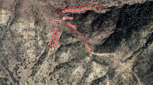

Image courtesy and © Ventura County Canyoneering
We made quick time of the rest of the hike, taking our lunch at Squaw Flat. There are fewer things better than kippered herring and crackers beneath a live oak on a Sunday afternoon, of this I am quite certain.
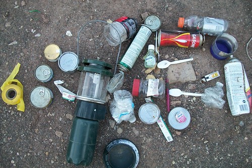
Some of our “Haul”
So still Saddle Skirt remains elusive. Somewhere up that ravine, an ice can or two sit waiting for my arrival.
But worry not, little ice cans: your Uncle Craig has a whole series of exploratories planned deep into that Cobblestone of Darkness….
Leave a Reply