Ellis Apiary

As something of a sidebar to the “Diamonds in the Rough” theme, Nico and I headed up to the Ellis Apiary site in the eastern Sespe Wilderness this past weekend. Even by the mid-70s, the route was considered to be in pretty poor shape. It’s not improved since.

The previous evening’s storm had left a fine low-level blanket of snow atop the surrounding hills, and as we headed out from the lower parking area aside Lake Piru (the Fernandez Launch being closed for the season), gloves were in order to ward off the chill.

On the Road

Blue-colic

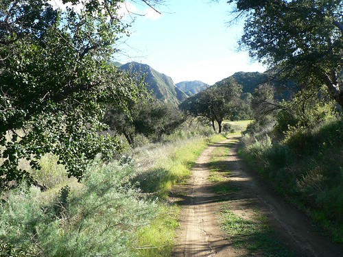
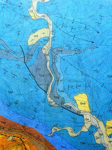
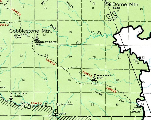
After the five-mile march along the service road, we picked around the wind- and water-eroded sandstone just north of Blue Point, and then continued easily through a few knee- and waist-deep crossings upstream of the abandoned Blue Point Campground and beyond the Whitaker Ranch and the Agua Blanca/Piru confluence. This entire route was an easy exercise along sealed road and silty double-track. A few hundred yards beyond the confluence, however, this easy route abruptly turned into the narrow cobble-strewn walls of the Juncal formation, and we spent the next hour wading, scrambling, and generally bushwacking through the vestiges of what had once been the Cobblestone Trail (18W03).

Lower Cobblestone Route: The Geology

Path of Least Resistance

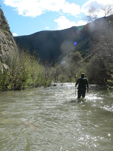
The water level was pretty high, so we were resigned to a few crossings which in drier seasons may be more of a rockhop across. The deepest reached my sternum, but none were overly challenging (the uber-hund may disagree on this final point, as she found herself surfing the rapids more than once).

Lower Cobblestone Route: The Topography

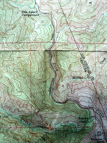
Once through the two stretches of narrow canyon, we followed the long-abandoned service road beyond the old site of a hydraulic mining operation, finally coming to the oak-shaded and grass-choked flat where stands Ellis Apiary campsite. Once the site of a commercial beehive operation (hence the name), we only saw a single bee (Omega Bee?). He was outnumbered by a unusually high number of spiders lurking in the grass on the flat adjacent to the camp’s main kitchen.

Type Unknown

Smear Tactics

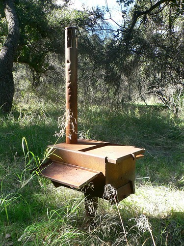
The site has certainly seen better days, but it was still nice to find yet another of these nearly-forgotten gems.

Somewhere up there, beyond the Turtle-Piru confluence and that southeast flank of Cobblestone Mountain, await two more sites … two little gems out there in the chaparral- and Douglas-fir-choked rough.

Soon enough, you two. Soon enough.

Daydreaming


Comments

5 responses to “Ellis Apiary”

  1. Looks like cool trip. that stove looks interesting. I wonder how that came to be. I wonder what the deal with 19W11 is? It seems strange that the trail would split and reconnect like that. It just feeds my curiosity. I too would like to see those other two camps, and drink from their springs. That blue map looks pretty cool.

    Take care

  2. Thanks EP. That map is one of the great Dibblee geologic maps, which used the USGS 7.5′ quads as the base layer (in this case, the 1964 Cobblestone Mountain quad).

  3. I am a thorough Masha fan. There is book for children here: The Adventures of Masha. Put me first on the list for a T-shirt (I’ll buy the book for the grand nieces and nephews and read it to them). So it seems access becomes ever more challenging. I guess I could always picture the closure of the road to Hardluck Camp, but Blue Point took me by surprise. Of course, I have been in exile for a long time and lack an informed perspective.

  4. Some trips have a really great destination that makes the trip worthwhile. Other times, it’s the walk itself.

    This trip was one of the latter types. The destination was a bit anticlimactic (aside from the really cool stove), but the walk there was really cool. The views of the Piru Creek valley at the inlet of the lake were beautiful and walking through the Narrows of Piru Creek was a relatively unique experience for our Southern CA backcountry. Felt like a mini, bushwhacking version of the Zion Narrows. I liked it.

    Thanks for having me along.

  5. Yes, the destination — as glad as I am to have seen it — paled in compare to those narrows. Was glad to have the company, Nico … especially when I took that accidental swim toward the end! 😉

    As for closures, these days anything that might adversely impact the arroyo toad (specifically, road crossings of or close proximity to the Piru or Sespe) has resulted in closed camps. I never found Hardluck all that enticing, but Blue Point is beautiful. I’m glad the temporary closure of Middle Lion a decade or so ago didn’t result in a permanent loss of that camp.

    Further, I’m not convinced the closure of Beaver is doing much good, as it’s become a dumping ground for lax shooters’ detritus (which I don’t remember seeing so much of when I camped there as a child). I hauled an old shotgun-blasted CRT monitor out of the Briggs/Sespe confluence there trip before last. What a bunch of knuckleheads.

Leave a Reply

Your email address will not be published. Required fields are marked *