The Decline and Fall of Western Civilization, Part 1:
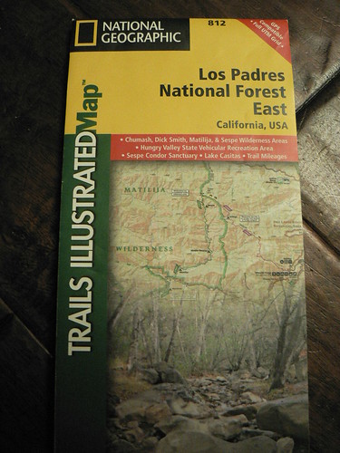
Trails Illustrated Map 812: Los Padres National Forest East
Prologue the First
Thank goodness George Bailey didn’t live to see this.
Sorry, let me back this up a few decades.
The first time I saw It’s a Wonderful Life, I was probably 6 or 7 years old, flipping channels and expecting the Family Film Festival (usually “The Three Stooges” and “Little Rascals”) on Channel 5. Instead I was greeted by a young George Bailey explaining to the others in the soda shop that he was a proud member of the National Geographic Society. This was before I had any concept of product placement, and I remember thinking that kid was awesome.

The yellow box that comprises the National Geographic logo meant more to me as a kid than the golden arches or any swoosh, no question. And their maps … oh, in the eyes of a little would-be (wanna-be) explorer, they were pure gold and I very clearly remember spending hours memorizing all their details. Between a) the dusty National Geographic atlases in the family bookcases detailing places like British Honduras, Northern Rhodesia, and an empire on which the sun never set and b) the 1943 Army Corps USGS quads we used to navigate the backcountry, I hugely admired both the NGS and the USGS for the products they put out. They were a cornerstone to a huge portion of my upbringing.
The Allies used NGS maps in their planning during the Second World War. FDR swore by them. Honest-to-god explorers vetted and vouched for them.
So when such famed cartographers set their sights on our beloved stretch of forest, the end result should be the most awesome Los Padres maps ever, n’est-ce pas?
Prologue the Second
In the Spring of 2012 — a few weeks after National Geographic released their first foray into the southern Los Padres (their Trails Illustrated Map No. 812: Los Padres National Forest East) — the resident science officer and the Los Padres Expat and I found ourselves enjoying a very chill evening at Sheep Camp in the Chumash Wilderness.
Whilst I was preparing dinner, I unpacked the camp library and handed the RSO the new map. The conversation went something like so:
“Here, while I cut up the onions, see what you can find. I found two errors in the first 30 seconds when it arrived a few days ago. I’m worried.”
“I dunno, I’m not quite the map connoisseur you forest-obsessed typo-sniffers are.”
“Well, whatever you find.”
“Okay, sure.”
The Subjective
It’s a beautiful map, and I love the compass on this series.
The Cold Hard Truth
The dicing of onions and peppers and browning of the steaks took 20 minutes. The consumption of a few Guinness maybe another 20. And after three-quarters of an hour, the RSO held a list of 42 errors.
So this is the tough-love section of the review.
The map seems to have been compiled from data, and data only. If the fine folks in Evergreen sent review copies out, they sent them to the wrong people (like armchair rangers and not the ones out pounding the trail cutting tread, wielding pulaskis, and earning the outstanding views).
I won’t inundate (read: bore) you with a laundry list of every nit we’ve found. Many are legacy errors that have reared their cartographically inaccurate heads over generations of USGS, USFS, and Harrison maps — e.g., Saddle Skirt’s placement, the misspelling of Bill Faris, the exclusion of Blue Jay and Rollins — and others I presume come from datasets not vetted for ages (Buck Creek designated as suitable for stock? Surely you jest!).
But for Skunk, Upper Santa Ynez, Ozena Fire Station, Ranch Nuevo (trailhead and camp), Tower, Elder, Howard, and the Thorn Point lookout to just not be on the map? That’s sloppy, and reminds me of the poor vetting the BLM cadastral maps exhibited where some typesetter keyed in “Bill Faris” as “Bill Fans” … it’s like they weren’t even trying. Further, numerous inholdings (Kerr Spring, Salisbury Potrero) are excluded.
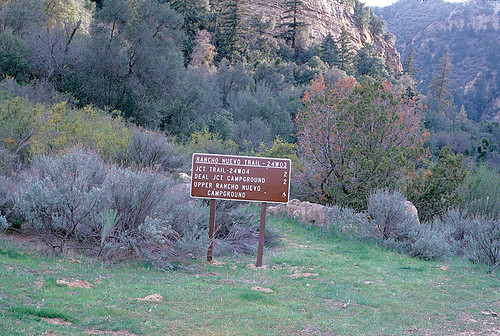
Rancho Nuevo Trailhead, 1985. And yes, it’s still there.
Image courtesy and © the Los Padres Expat
And so on that topic bent, McMenemy is misspelled. So too is Haddock (never mind that on this map, the Reyes Peak Trail and the GM/PB NRT don’t even connect). Wills Canyon is also misspelled. Sure, Kirschenmann is as well (even the best missed that the first time around), but it’s spelled two different ways.
Some of the forgivable errors are again legacy errors that betray an over-reliance on data in this age of digital cartography. “Lily” v. “Lilly” (but spelled both ways, which I do not forgive) up along the North Fork Lockwood trail; Upper Matilija not shown though (despite its 1974 abandonment) it has in recent years been re-embraced by the Ojai RD; etc.
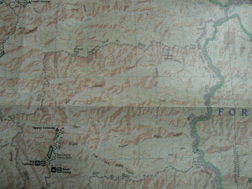
But who knew “La Catpa Potrero” was near the headwaters of both “Aqua Caliente” and Agua Caliente Creeks (because it’s labeled both ways) … if only I could determine which of those passes over “Big Cliente” Debris Dam. (You can’t make this stuff up.)
Hardluck camp — abandoned years ago — is shown as a viable camp and trailhead. No. The upper stretch of the Santa Paula Canyon/Last Chance trail (the Don Board Memorial stretch) is not shown at all. The placement of Shady Camp near the Alder/Sespe confluence is incorrect, almost as though they pulled from the 1991 USGS Devils Heart Peak set rather than the 1995 (that being one of the few correction the 1995 series got right).
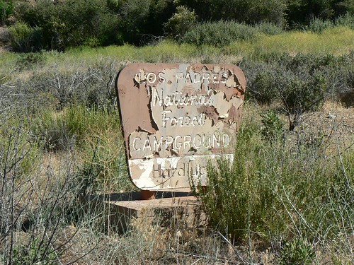
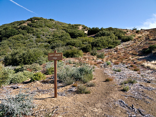
Image courtesy and © the Los Padres Expat
There’s no trail to either West Fork or East Fork Lion Canyon (never mind the falls, also not shown). The Mt. Pinos Botanical Area is not shown. The Stewart Canyon Debris Basin (the Pratt TH) is labeled the “Stewart Canyon Debris Burn” … we weren’t sure if that was a nod to the fires in the past decade, a subtle poke at Caledonian trampers of the Ojai frontcountry, or just … okay, yeah, it’s just sloppy mapwork.
The nitpicky? 812 does’t show the latrine at La Cumbre Peak. (If you drive that road with little kids, that’s a key piece of intel.) Inconsistent use of the same terms, most notably when referring to recreational vehicles in the plural. It’s “RVs,” not “RV’s” … but both are used. A Santa Barbara RD label keyed in as “santa Barbara R.D.” ….
I will admit I gave up when the list went to three pages (two columns per). I take some solace in the text block wherein the NGS states “NATIONAL GEOGRAPHIC TRAILS ILLUSTRATED maps are revised regularly in cooperation with the US Forest Service, CA State Parks and others. Changes do occur between map revisions.” (This was the part where I noted inconsistent use of the serial comma, but never mind that right now.)
National Geographic Society, I still love you.
But Map 812, I know National Geographic maps. National Geographic maps are friends of mine. And you, sir, are no National Geographic map.
Leave a Reply