Some years ago, the Resident Science Officer and I hit upon an idea to spend 40 days and 40 nights in the Los Padres in the Fall of 2013.
But you know what? Real life always gets in the way of our crazy plans. So instead, we opted for 3 nights along Kennedy Ridge and the far East Camino Cielo.
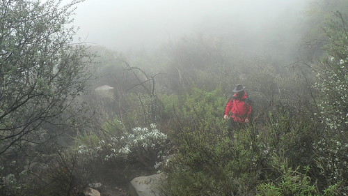
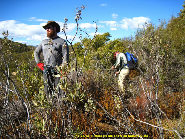
“We’re Gonna Get Bloody on this One, Rog.”
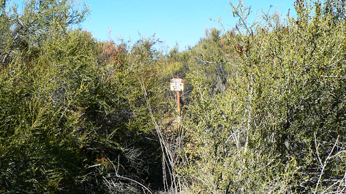
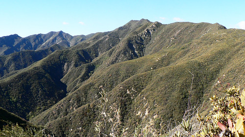
Now, any regular reader of this site likely has some familiarity with the far East Camino Cielo, as it has been a locale of particular interest to me and mine over the past few years.
The RSO Along the East Camino | Late Fall 2012
For this trip, the RSO and I set a number of very informal possible goals.
1: Wander.
2: Wander some more.
3: Test my new solar charger.
4: Wander thusly even further.
5: See if we could match up a few more historical photos I’d uncovered with their modern location, Expat style.
6: If we wandered with enough ease, recover the monument at 3496′ along the East Camino; and
7: Reach the end of the old road where it once met the junction of the Ocean View Trail (24W08) … last navigated by John Boggs in the late 1970s/early 1980s.
It had been a while since the RSO and I had had the chance to hit out for an overnighter, so to be totally honest the real goal here was just to get outside. If we met any of numbers 1 through 7 (or none), as long as we returned with minimal blood loss this trip would be a success.
Point 5 — that of matching up some photos with modern conditions — had been especially bolstered with the recent trailwork done by the Monte Arido Trail Angels, who through sheer fortitude and force of loppers has recently come across the site depicted in a photo I’d unearthed in the USFS archives some time ago:
Along the Ocean View Trail | 1923
Along the Ocean View Trail | 90 Years On
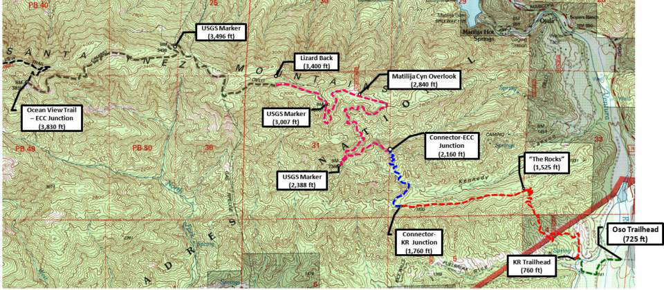
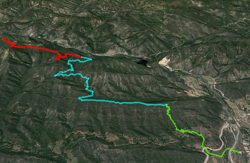
Volunteer Map Depicting Present, Past, and Future Route. Black=Uncleared Route.
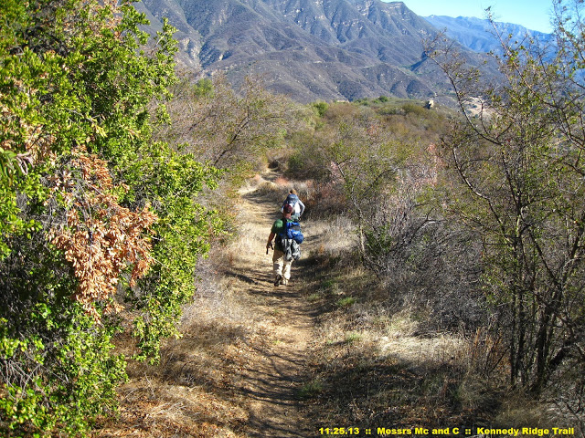
So after a stop at In N Out for some animal-style burgers, the RSO and I walked into the OVLC’s fine Oso Trailhead sometime shortly after 9pm, and headed down the trail with 5 gallons of water strapped to our backs, crossing the Ventura River under lamplight, and ascending the singletrack into USFS lands.
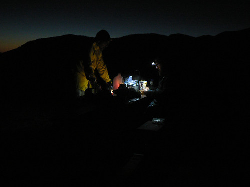
We arrived at USFS Table No. 1 sometime after 10pm, and laid out the tarps. The irony we were spending the 50th anniversary of President Kennedy’s assassination atop Kennedy Ridge wasn’t lost on us.
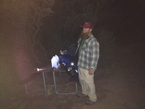
USFS Table No. 1 Under Cover of Night | Fall 2013 | Image courtesy the RSO
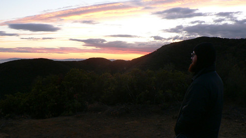
We awoke the next morning earlier than I really cared to, and instead of preparing breakie at our camp, moseyed along the ridgeline to the USFS Table No. 2, where I determined some of our cached water had been “borrowed” by somebody who backwashed horribly and apparently subsisted on a diet of bagels (ewwwww).
Glad we’d hauled all the water we had with us, I cracked open the eggs and bacon and set to making a proper breakfast. The pace we’d effected thus far was working out just right, and I was guardedly optimistic I’d be awake some time around noon.
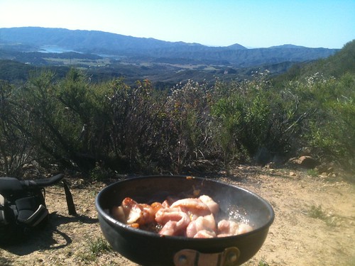
Breakfast Along Kennedy Ridge
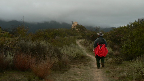
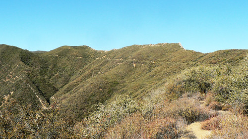
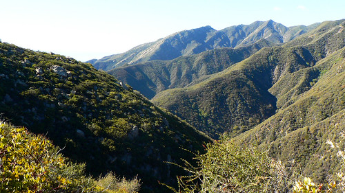
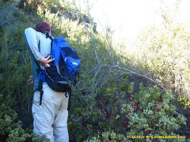
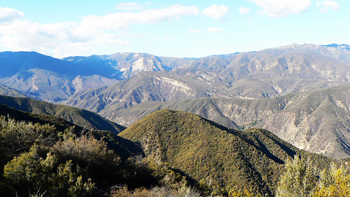
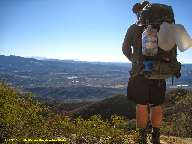
From the second table, it was the familiar scramble up to the old road cut. We’d made this hike a few times of late; once in the heat and once in the thick fog and drizzle (three guesses as to which we preferred). This time however we had pleasant temps with bluebird skies, and enjoyed the commanding views from USFS Table No. 3 there where the single track rises up to meet the road.

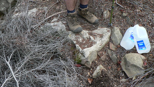
Most of the road is well cleared these days, so it was a lazy and pleasant amble as we ascended steadily up the old road cut (what old USFS records label a “truck trail”). We documented the typical minutiae — monuments, infrastructure, and the like — and would have done just as well to take a nap under an oak, we were in so little a hurry. It was a fantastic mosey.
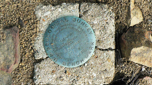
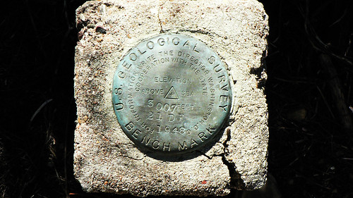
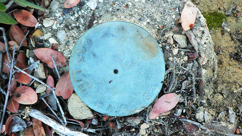
Monument 20-DF
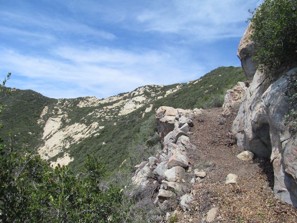
Old Rockwork Along the East Camino | November 2013
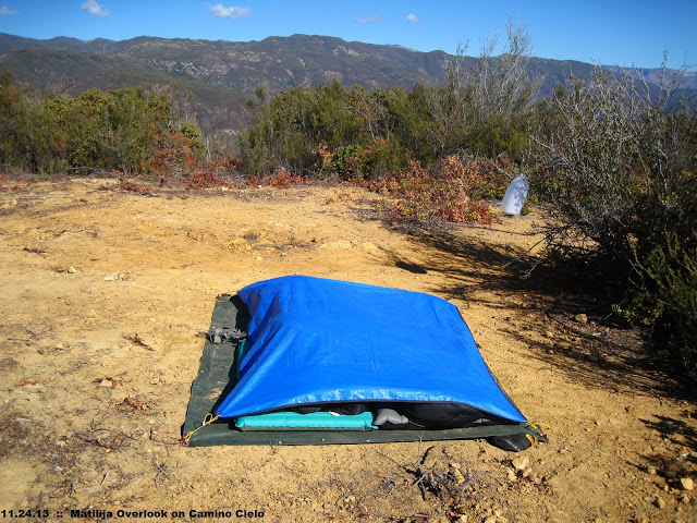
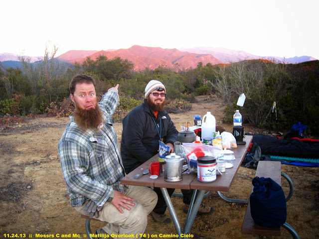
As we were approaching USFS Table No. 4 (also known as Matilija Overlook, a dry camp situated on an old helicopter pad) and had paused for some sustenance, we ran across Millennium Twain, local wanderer of the wood with whom we’d crossed paths only months before. Millennium related to us he was less than an hour from having spotted a black bear up the road, near a stretch dubbed the “Lizard Back.” He even had the photo to prove it:
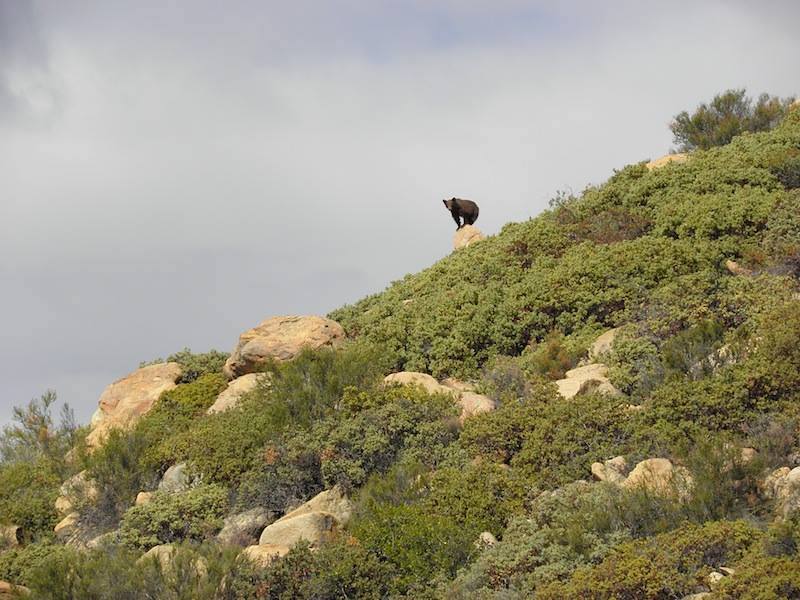
Ursus eastcaminocus | November 2013 | Image courtesy Millennium Twain
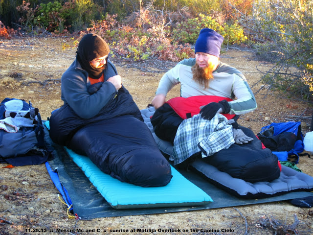
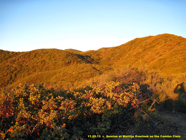
We finished our oysters and kippered herring as Millennium bade us goodbye, and in short time gained the ridge and then Matilija Overlook. Being in no particular hurry (and knowing the views from USFS Table No. 5 further ahead aren’t as fine), we figured this was as good a spot as any to fire up the stoves, tinker with our cameras, and in general laze about. There was gin involved.
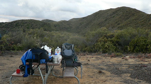
Matilija Overlook Camp, Dusk | November 2013
The next morning, the RSO and I were up early, but that’s primarily because the earlier it is, the better the bacon tastes. In time we packed out kits for the day, double-tarped the beds, gathered our tools, and were off.
To the Hills!
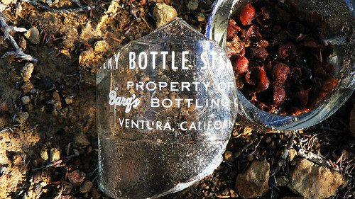
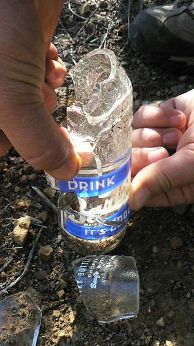
The weather was great, and we enjoyed gathering monuments, unearthing root beer bottles from the mid-1960s, and pushing through the increasingly thick brush of the route. While this wasn’t yet to the level of the Sespe Brush Ninja induction ceremony, things were slowly getting thick.
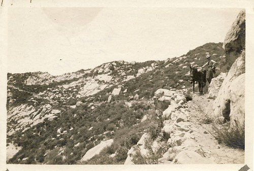
Along the way, the RSO and I stopped every so often to survey the area and compare topographic features with these two photos:
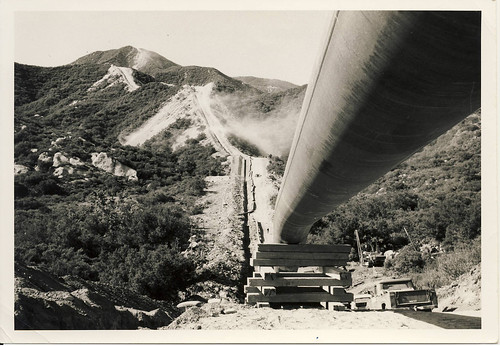
Richfield Pipeline Under Construction, 1958
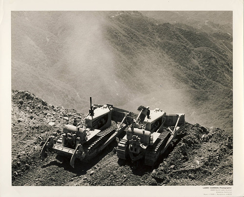
(Far) East Camino Cielo Under Construction, 1958
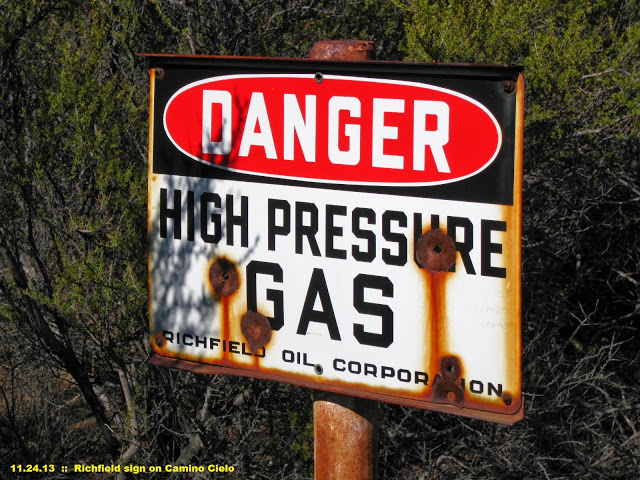
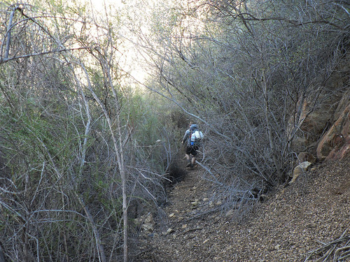
… in the hopes of matching them with our location and getting a bearing further up the old route. In short time we crossed the old Richfield (now ARCO) pipeline that travels from Taft to Mandalay Beach (Oxnard). And still the brush continued to close in. We were clearly approaching an area where fewer and fewer people had trod of late, and we were now well into the stretch of route the volunteer maps showed as “unworked.” Would we have it any other way? No, no we would not.
And then, quite suddenly, we hit the proverbial wall of chaparral. A pair or two of footprints could be faintly seen dropping off the roadbed and scrambling along the steep slope, so I followed those for nearly 100′ before scrambling up a ravine where the footprints returned to the roadbed and continued up-trail.
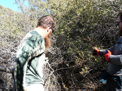
Unacceptable! I double-backed to where the RSO stood ready with our tools, and we agreed in short order it was our moral obligation to clear this swathe of unyielding brush. Clippers, Sven saws, and bad attitudes were brandished, and on our hands and knees and with twigs weaving themselves into our beards like an out-take from The Hobbit, we laid bare that beautiful road bed. It’s a super-highway now, thank you very much.
You’re Damned Right We Shall Pass! Stand Back!
After a solid hour or so of clearing that stretch of road (and tossing all the brush across that pitiful use trail along the slope), we stopped for some whisky, cheese, and lunch. Whilst lounging in the dry leaf fall of a particularly massive laurel sumac (I may have taken a nap), we noted a lone paraglider sailing overhead. He was soon joined by a second, then a third. What a wonderfully unique perspective those folks must have these near-forgotten stretches of our forest.
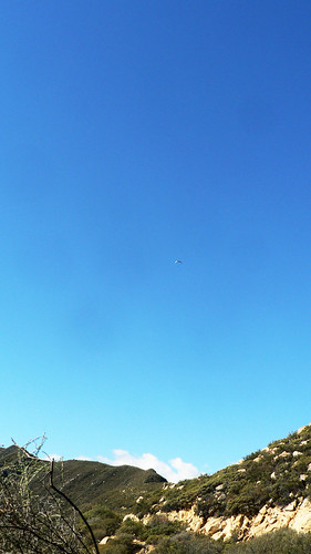
No Really, He’s There.
As we began to pack up our victuals, we heard a creature crashing through the brush down trail.
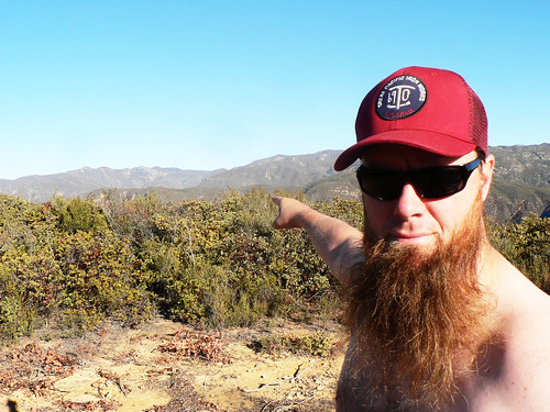
It was Bardlero Primero, Patron Saint of the 20W15, coming in hot! We greeted him and after another round of beverages (he came prepared, of course), we, now a merry party of three, continued upward and onward.
And still did the brush close in.
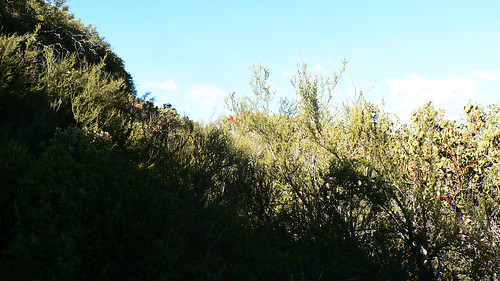
More than once I had to throw out a moose call to get a bearing on where the RSO — who’d mercifully taken the lead on this stretch — was. The brush was far higher than we were tall, and only by virtue of spotting his red work gloves held high was he visible for many stretches. It was all getting rather silly.
“Over Here, Dude.”
We again crossed the pipeline, and so knew we were approaching the next monument, at 3496′.

Soon, we reached the bend in the road, and we were met with an almighty wall of manzanita. We surveyed numerous stretches of the roadside, areas that looked as though 65 years prior may have been an ideal spot to set a monument, but in the end conceded it had fallen victim to an obvious landslide/slump we could see, or we simply weren’t finding it.
It had been a good day. We’d cleared an inordinate amount of brush, the RSO was bleeding rather impressively from his upper arm, and we’d gained views of known features from vantage points previously unwitnessed by we three. So we called this bend a fine point from which to launch a future trip. It was time to go cook up supper.
Back to Camp!
We pushed through that ridiculous brush those few miles back to our camp at USFS Table No. 4, and enjoyed a cold evening under the stars with fine company and fine single malts.
The next morning we rose with the sun, and Bardlero led the charge for some early-morning goofery and idle photography (do note all photos contained herein that feature the integrated captions were lent courtesy his charity and goodness).

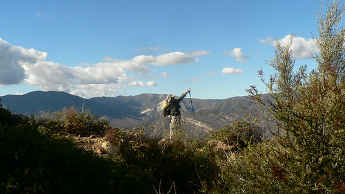
Hey, Which Way Next Time?
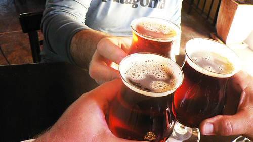
And so we began the trek back into Ojai …
… where awaited us strong brews and hearty fare.
Go get some!
(The first section of this trek is described in Route 53 of Hiking and Backpacking Santa Barbara & Ventura.)
Leave a Reply