Over the past month, the crew has been spending a disproportionate amount of time along the Santa Ynez River (the road along which has been closed at First Crossing for about the same duration).
During those crazy rains the week before Christmas, we did the Arroyo Burro traverse from First Crossing to the Cater Plant in Santa Barbara.
Two weeks later we hiked the Matias Potrero trail and then returned along the (closed) road, wading the crossing near Falls and at First Crossing.
We didn’t see a soul on either trip; without the vehicle traffic the Santa Ynez Recreation Area is more of a “Seclusion Area” right now … and it’s awesome.
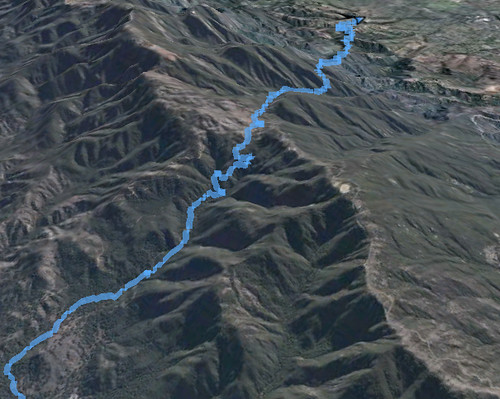
So with that in mind, DAW-G and I grabbed the uber-hund for an 18-mile loop starting and ending atop East Camino Cielo.
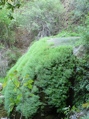
We started with the pleasant drop from Cold Spring Saddle into Forbush Flat, then up the knoll past the Mono/Blue Junction and through the bigleaf maple- and sycamore-shaded ravine. Here there are some great pools formed partially by the creek’s mineral content, ending with the most impressive of them (known often as the Emerald Pool.)
Just downstream is the eastern end of the Gibraltar Trail, which follows a long-retired service road. We left the shade and cool of the drainage and immediately came out into more “classic” light chaparral and yucca as we headed west toward Gibraltar Reservoir, weaving in and out of drainages which alternately exposed us to the weak winter-morning sun over shale and talus, or left us hiking in the cool shade of oak-lined glens.
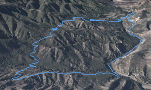
A few relics of the former road — a battered fifth-wheel and then the chassis of what was likely a Depression-era trailer of some sort (the chrome bumper wasn’t in too bad a shape, to be honest) — ushered us onto the crumbling stretches of the old red rock aggregate that once comprised the road.
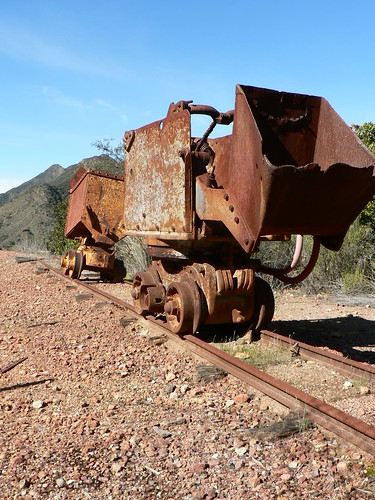
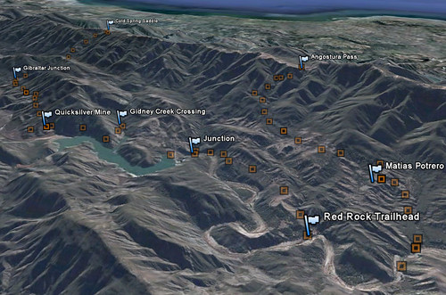
A short stretch along this widened route led us to the junction with the shuttered Sunbird mine, which once pulled quicksilver from the hills above the reservoir. One can’t help but wonder what precautions are in place preventing the inadvertent release of mercury into the reservoir (which is part of the Santa Barbara municipal water supply), especially with the mine tailings situated there directly on the water’s edge. We explored the mine grounds while taking lunch, and then continued along the old road toward the Gidney Creek crossing and finally to the dam proper (no longer accessible to the public).
Once beneath the dam, we spied the old Gibraltar camp across the river, which from 1914 to 1920 housed the workers building the dam, and then in the 1930s was converted to a campsite under the auspices of the Forest Service. Heavy use saw the site converted to day use in the 1970s, and then in the past few decades the site was phased out altogether. The footings of the old buildings and even the bathroom steps are still easily identified.
Having made fairly good time and with plenty of sunlight left, we endeavored toward Red Rock, and slept beneath a massive live oak beside the river. Twelve miles this first day, and a fine descent from East Camino Cielo.
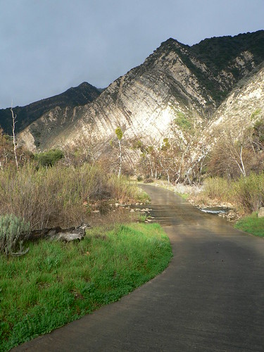
We awoke with the sun, enjoyed a lazy breakie, and then abruptly the rain arrived. So we broke camp with a touch more urgency, and started our second day with the five crossings of Paradise Road (all five were cold, I must confide … genuinely ankle-aching cold).
Once past both of the Red Rock sites and then Live Oak, we cut south up the Matias Connector, bearing our loads in intermittent rain and under the watchful eye of one rather persistent red-tailed hawk. The uber-hund — 9+ years old and unphased by the previous day’s exertion — busied herself with flushing out quail while she patiently endured her bipeds’ slower pace.
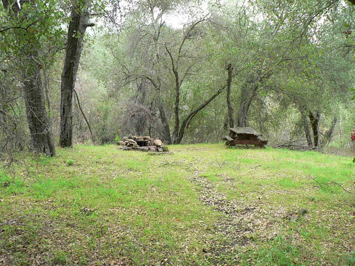
We took lunch at the old Matias Potrero campsite (a fine spot, but a curious place to set a camp), and then (in no particular hurry) continued now on our eastward tack toward the junction with the Devils Canyon route.
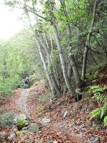
Having trekked the Matias route previously, it was a pleasant surprise to find it recently clipped (and we’re talking ambitiously clipped, because it felt like a thoroughfare in parts), and we made good time to the junction. From the trail junction, it was a slow march up the northern flanks of the Santa Ynez mountains — rain and fog taking their respective turns in keeping us company — back to Angostura Pass at East Camino Cielo.
A great exploratory in fine weather (for those who prefer the fog and drizzle, as we do) … this route could easily be made a daytrip with an early enough start.
Leave a Reply