Welcome to the Roaring Twenties
Time now to tick another Range westward and tackle the Series 20 West (see previous entries detailing Series 19 West and Series 18 West).
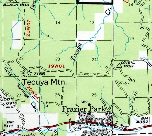
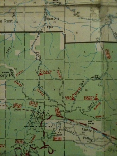
20W01
Salt Creek (FS Road 9N53/Trail 112)
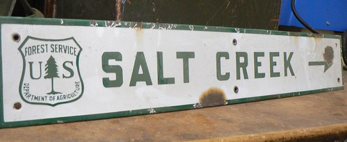
A 4WD route north of the San Andreas Rift Zone, this route is shown on legacy maps (e.g., 1967) as 20W03. Closed in the winter, this is a popular stretch of the Forest for hunters and 4WD-campers not given to the crowds of the Pinos summit area. It’s also a great spot for kids to explore; this is an empty but well-treed corner of the LP.
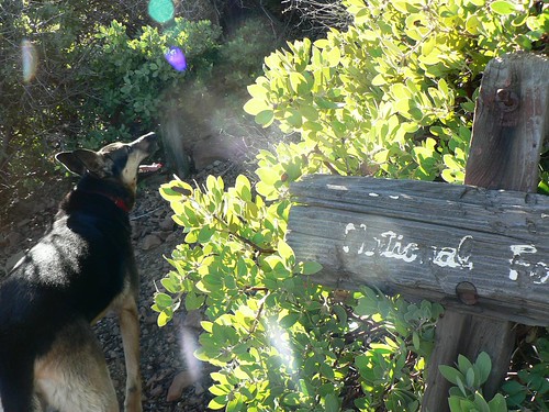
20W01A
Sycamore Trail
The sub-designation to this is a bit perplexing, as this long-abandoned route once led from Mutau Flat southward to Willett Hot Spring. More on this later …
20W02
West Frazier Mine Trail (FS Road 8N42/southern half, Route 118) or the Black Bob/Deadman Creek Route
And right away we have a mystery, as the 20W02 appellation is applied twice over the years. See 20W03 below for the West Frazier Mine option.
20W03
West Frazier Mine Trail (FS Road 8N41/northern half, Route 118)
An OHV route, this route (as its remain implies) runs along the western flank of Frazier Mountain, and through the labyrinthine network of old mine claims. The USFS recently completed construction on a very nice trailhead and parking area for the upper terminus of Trail 118, just up-road from Chuchupate Ranger Station.
20W04
Cold Springs Trail … or Yellow Jacket Trail?
Curious cartographic conundrum here, in that for ages maps have labeled the route now known as Trail 116 cutting through Cold Springs Canyon (above Frazier Park) to be the 20W04 … yet there’s a very old flame-cut sign along the Yellow Jacket Trail marked 20W04. A result of designation shuffling, or an error committed ages ago and perpetuated ad infinitum by government cartographers? Older maps show Yellow Jacket as the 20W24; after some years off the map the designation reappeared in the Mt Pinos District’s 2011 “Motor Vehicle Opportunities (East)” map.
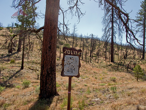
Image courtesy 100 Peaks
20W05
Arrastra Trail (Trail 121)
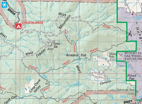
Steep. This route drops down Maxy Canyon from atop Frazier Mountain, meeting the Tejon Trail (19W03; Trail 122) at Arrastra Flat.
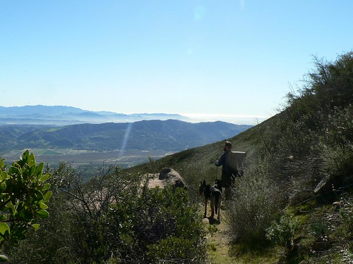
20W06
Miller Jeep Trail (Trail 127)
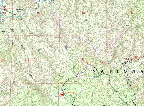
The Miller Jeep Trail climbs the northwest flank of Alamo Mountain from Sunset campground to Dutchman campground.
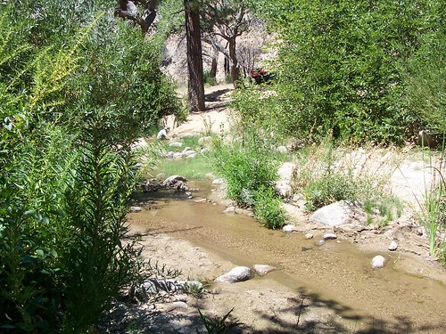
Image courtesy Calif_Princess
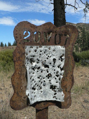
20W07
Piru Trail (Trail 128 [and then 132])

From Halfmoon campground, the Piru Trail heads downstream — passing several notable tributaries and historical trail junctions — meeting Sunset camp just past half-way and then ending at Gold Hill Road just above the Kings camp spur road.
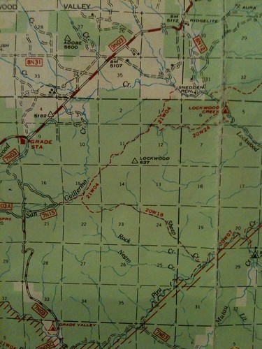
20W09
FS Road 8N12A/Trail 125
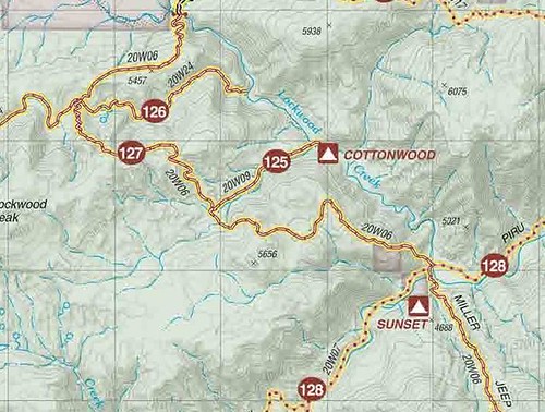
Another OHV route, this one leading to Cottonwood camp on the banks of Lockwood Creek.
20W10
Little Mutau
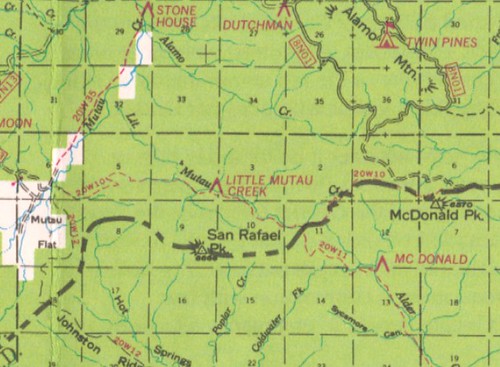
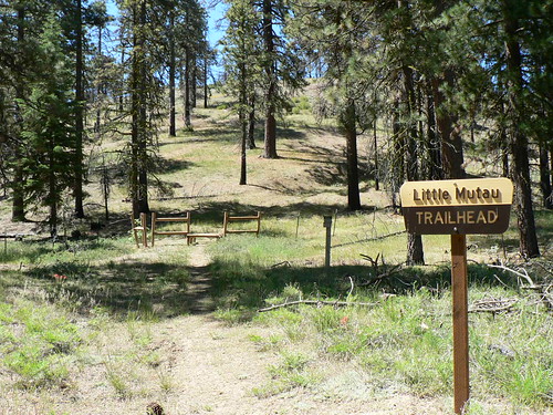
And finally, we get back to some hiking here. The Little Mutau — now with its nice trailhead at the eastern terminus atop Alamo Mountain — cuts across a piece of the Sespe Wilderness along its namesake watershed before meeting the Johnston Ridge trail just upslope from the Mutau Creek crossing.
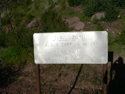
20W11
Alder Creek
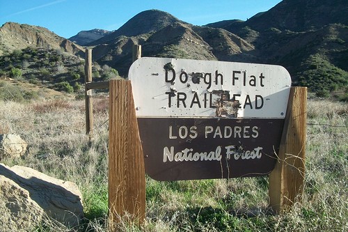
This route — once drivable to Cow Spring until Squaw Flat Road’s closure in the early 1970s — once led from Dough Flat into the Alder Creek drainage and then climbed the East Fork (passing McDonald Cabin) to meet the Little Mutau Route (20W10). The upper stretch has largely been abandoned post-Day Fire.
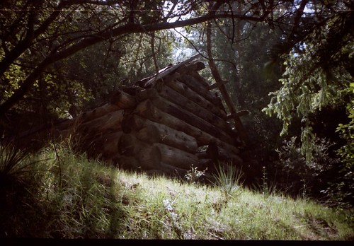
McDonald Cabin, Spring 2000. Image courtesy Carol Day
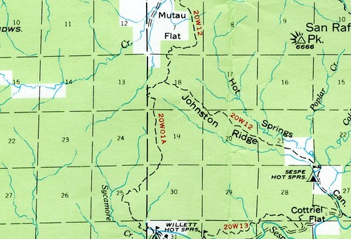
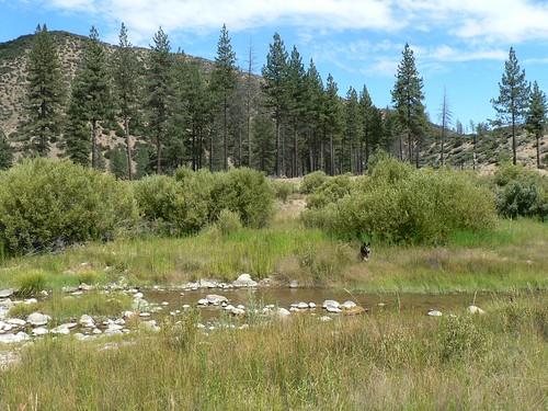
20W12
Johnston Ridge
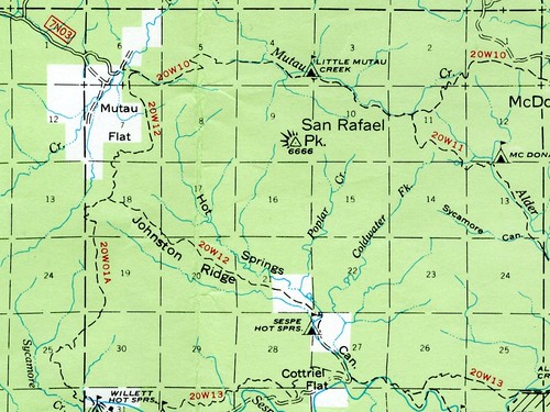

Image courtesy Roy Ubu
Staying true to the 20W Series’s OHV heritage, this former motorcycle route, vilified in the early Gagnon guides for its noise and dust, is now within the Sespe Wilderness (not that such protection prevents the occasional knucklehead from riding it).
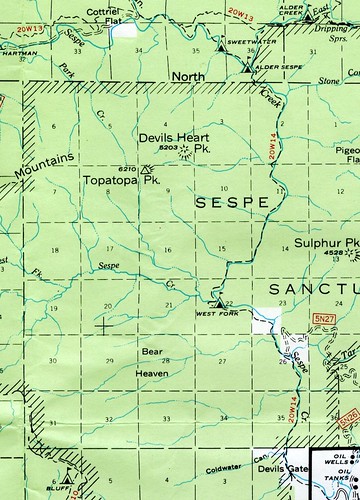
20W13
Sespe River Trail
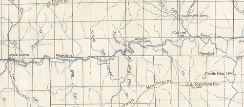
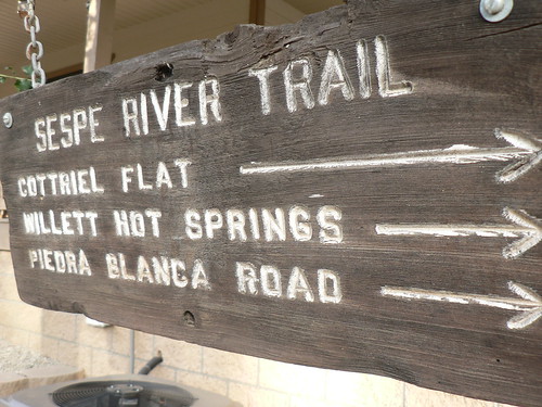
The well-known route following the length of the old Sespe River Road from the former Lion Campground to the turnoff up Hot Springs Canyon (see 20W30 for the rest of the route toward Alder Creek).
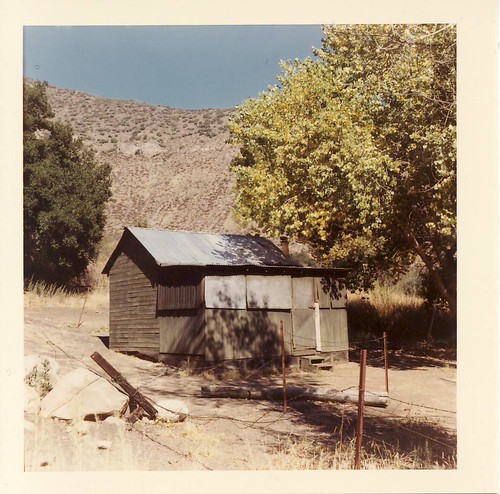
Cottriel Cabin, October 1968. Image courtesy LPNF Archives.
20W14
Devils Gate
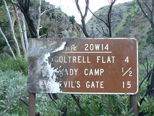
Abandoned, but still viable if you don’t mind wet feet. This was my first “epic” Los Padres route. In the years before the formation of the Sespe Wilderness, I followed Billy Monster, Quiche, and Rohair down this route to the bitter end (we got caught by Mr Van Trees and got yelled at … when you’re 12 that leaves an impression). 😉
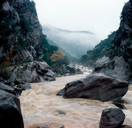
Image courtesy bobby_emm
20W15
San Cayetano Peak
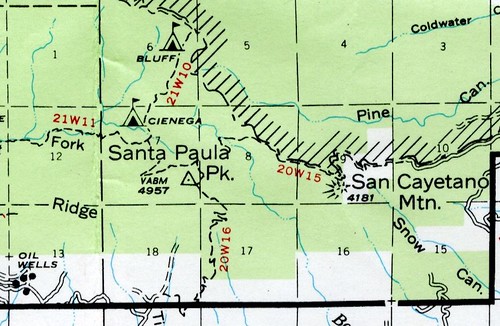
Long-abandoned, this route has in recent years been scouted and gently clipped by Bardlero Primero. One can only hope it will again be a viable route someday. See his photo set here for an idea of conditions; since early 2011 he and his stalwart companions have visited half a dozen times, wielding the Fiskars in hopes of reclaiming the route.
20W16
Santa Paula Peak
Though access falls in the gray area lest one approach via the hammered East Fork Santa Paula route, the trail is still in fantastic shape. The scattered remains of the Santa Paula Peak lookout (lost in the 1948 Wheeler Springs Fire) and fantastic views avail themselves atop the peak. See the trip report from our Winter 2011 trek through that corner of the forest here.
20W17
West Tecuya Trail (Trail 114)
Back amongst the OHVers now.
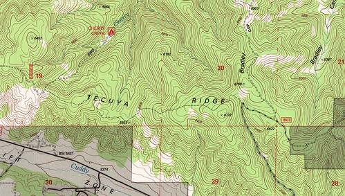
20W18
Sheep Creek Trail
Long-abandoned, but the lower portion of this route appeared on the 1995 Lockwood Valley topo.
20W20
Cherry Creek (Trail 113)
New maps show this route as 20W14, but that designation belongs to the Devils Gate route, and I won’t yield in that assertion. Is the Forest Service re-distributing designations in the wake of the numerous abandonments? Possibly.
20W21
Escapula Ridge Trail
Abandoned OHV road.
Stopping for a moment now to reflect on the fact that — in one form or another — all routes from 20W01 to 20W21 are accounted for, save 20W19. Anyone?
20W24
Yellow Jacket Trail (Trail 126)
(No, the other one.) Still not sure what to make of this discrepancy (see 20W04, above). To further muddy the water, it’s also labelled as the 21W04 on the 1968 and 1969 LPNF visitor maps.
20W25
Whata Trail
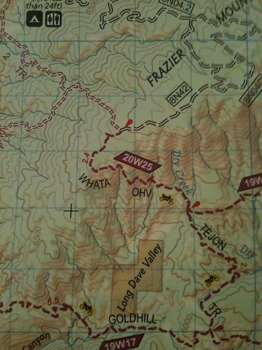
(No really, that’s its name). This OHV route drops from the south slope of Frazier Mountain into Long Dave Valley.
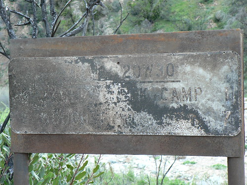
20W30
Upper Sespe River Trail
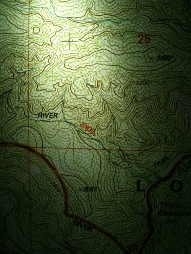
There’s very little legacy with regard to this trail designation, but it was — for a time, anyway — the label given that small bit of trail east of the Devils Gate (20W14) drop-in near Hot Springs/Sespe confluence that heads over the hump and down to Alder Creek (between Alder Creek and Shady camps). When was this decided, and how does it come in (ordinally) before Stonehouse, which has been a route for ages?
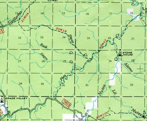
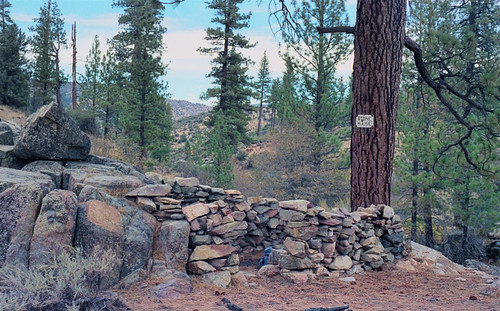
20W35
Stonehouse Creek
The Stonehouse route — the namesake stone cabin and campground no longer appears on USFS maps — follows the lower stretch of Mutau Creek from the edge of Mutau Flat to the Mutau/Piru confluence, where it connects with 20W07.

Image courtesy Roy Ubu
Stonehouse Camp, Fall 1986. Image courtesy the Los Padres Expat.
Then there are the routes that were probably in the 20W series. Pigeon Flat? The little spur heading up the Little Mutau from its confluence with Mutau Creek? The mind boggles at the tangled web these maps weave ….
Leave a Reply